


Kali Nadi

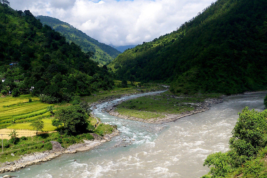
Kali Nadi or Kala Pani is on the Om Parvat route embraced with pine, juniper, and Bhojpatra trees and the mighty Himalayas stand tall guarding it. It is situated near Lipulekh Pass at an altitude of 3600 meters. Kali Nadi is also known as Sharda River, Kaliganga, and Mahakali. It's an ideal tourist attraction when you head towards Om Parvat with a wide range of flora and fauna and the famous Kali Temple which is also the origin of Kali Nadi.
It is said that sage Ved Vyas meditated here in a cave near Nag Parvat and Kali Nadi, it is now a popular attraction among all the tourists visiting here. There also exists a small shrine dedicated to Goddess Kali, after whom the holy river is named. Hence this river is of great importance in Uttarakhand.
The Kali Nadi in Kalapani also marks the border between India and Nepal. It passes through the town of Dharchula, parallelly with Nepal border before exiting the mountains. The Kali Nadi joins Gori Nadi at Jauljibhi. The various tributaries of Kali river are Dhauli Ganga, Chameliya, Saryu River, Ladhiya, and Ramgun.
The Kali Nadi flows maily through Uttarakhand to enter Uttar Pradesh to join Ghagra river, covering a distance of approximately 350km. The banks of the Kali River are home to several of Pithoragarh and Champawat districts' major towns such as Dharchula, Jauljibi, Pancheshwar, Jhulaghat, Tanakpur, and Banbasa, among others. Due to the Kali river, the Champawat region, which previously served as Kumaon's capital, is often referred to as Kali Kumaon.
Best way to reach here is from Pithoragarh and taking a stoppage time in Dharchula and after that leave for Kala Nadi where in between you will also witness the Nag Parvat and Kali Mandir.

Have An Enquiry? Write To Us…


